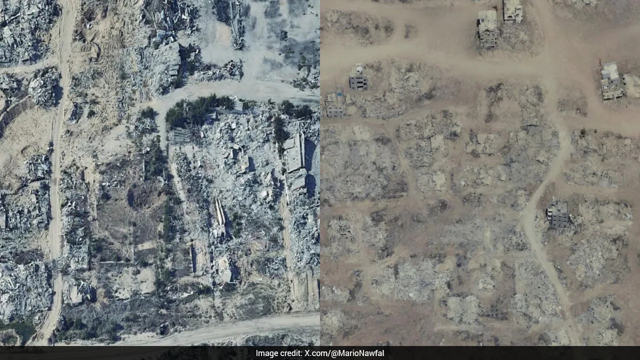
Entire neighborhoods are gone.
If you open Google Maps right now and zoom into the Gaza Strip, you aren't looking at a living map. You're looking at a digital ghost town. Recently updated satellite imagery has laid bare the staggering scale of destruction across the Palestinian territory, turning familiar urban grids into vast, grey expanses of rubble.
For months, journalists, human rights monitors, and displaced locals have documented the humanitarian catastrophe on the ground. Statistics tell part of the story. The United Nations reports that roughly 1.9 million people have been displaced, with more than 60 percent of the population losing their homes entirely. Assessments from international bodies indicate that recovery and reconstruction will demand tens of billions of dollars, given that over 90 percent of economic establishments and hundreds of thousands of housing units have suffered critical damage or total collapse.
Numbers are abstract. Maps are personal.
When high-resolution satellite imagery drops onto a consumer platform used by millions every day, reality sets in differently. Schools, parks, mosques, and restaurants still show up as little digital pins on your screen. Yet if you check the actual terrain beneath those pins, the buildings are flattened. You can scroll through streets that no longer exist, past storefronts where people once bought coffee, now buried under tons of concrete.
The disconnect creates a haunting user experience. Local journalists who have walked through the physical debris report that looking at the digital update is almost harder to stomach than seeing it firsthand. Standing in the ruins is localized and visceral. Seeing the entire territory rendered as a monotone wasteland from above exposes the absolute totality of the destruction in a single glance.
Take Al-Shifa Hospital. Once the crown jewel of Gaza’s healthcare network, international missions that inspected the site after military sieges described it as an empty shell. The updated maps confirm the severity of the damage inflicted on major medical and civic infrastructure across Khan Younis, Rafah, and Gaza City.
Why does this matter beyond the initial shock value?
Open-source intelligence and satellite archives serve a vital function in modern conflict documentation. When independent journalists face restrictions or extreme danger on the ground, high-resolution commercial imagery provides an undeniable baseline record. It creates accountability. Months or years from now, when rebuilding discussions or legal investigations begin, these time-stamped visual records will serve as primary evidence of what stood and what was erased.
For now, the updated maps remain a stark reminder of a humanitarian crisis that continues to unfold daily. It's a digital monument to loss, hiding in plain sight on an app most people use to find restaurants or check traffic.